GeoTrax Survey
Solutions

Affordable Surveying Services

Our Services

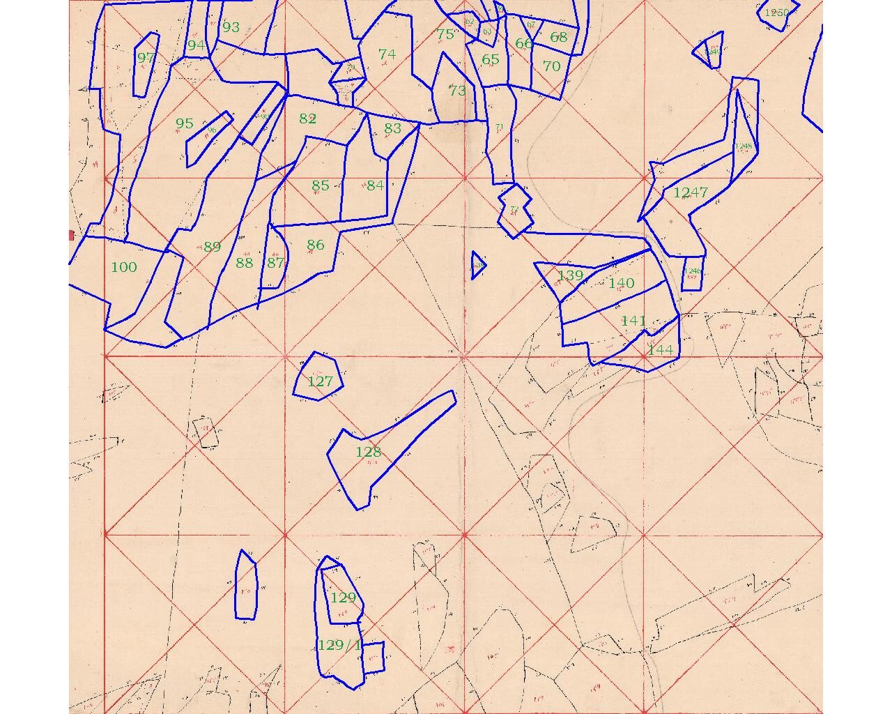
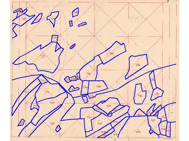
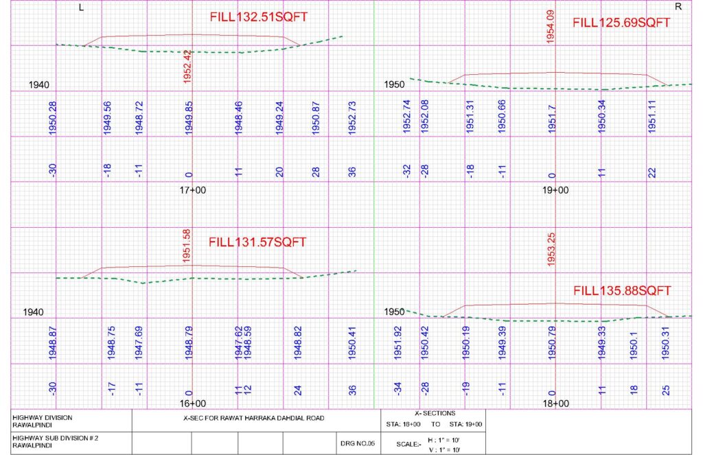
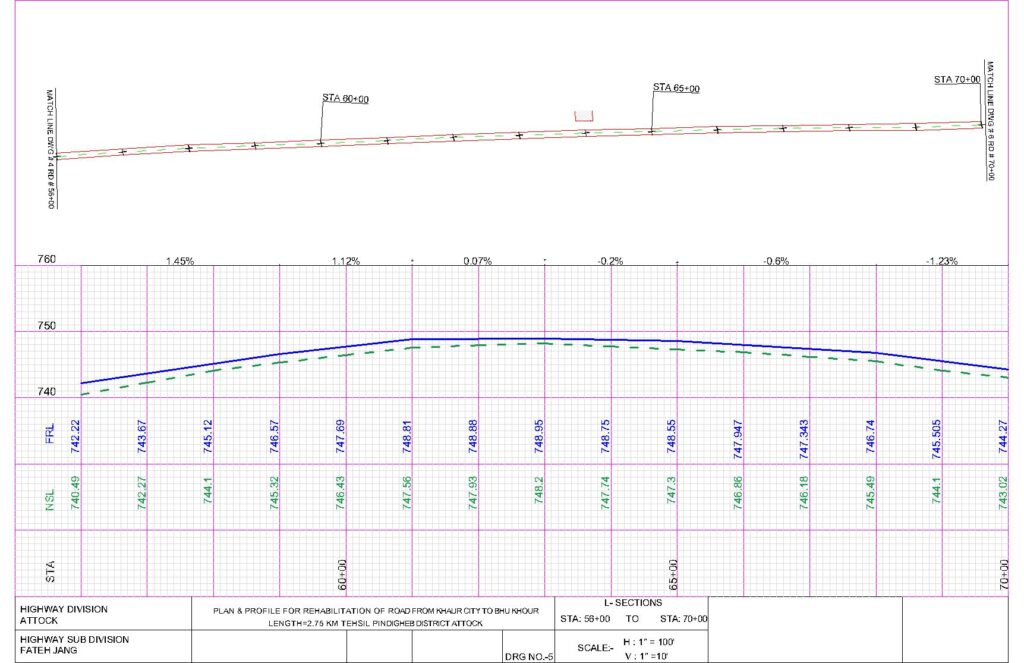
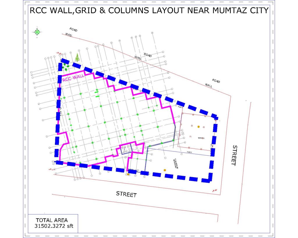
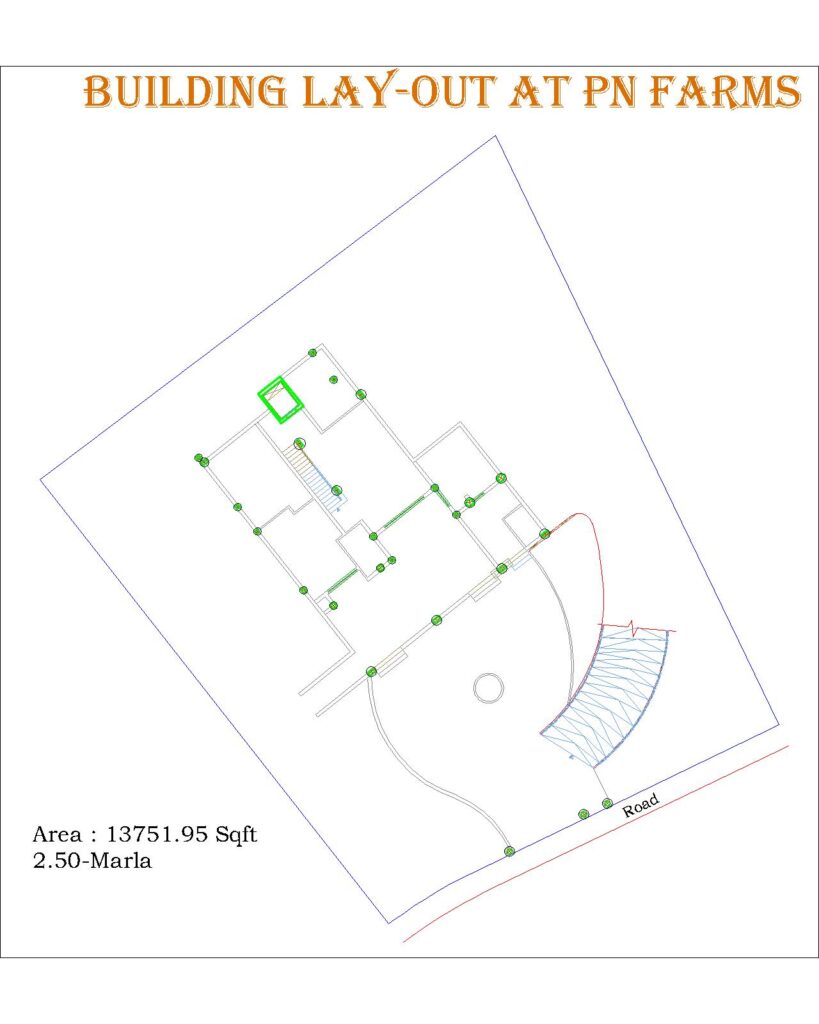
Topographic & Contour Survey.

The survey shows the features on the ground such as buildings, boundaries, roads, tracks, footpaths, water tanks, drains, electrical lines, nallahs, water channels, and all other features that exist on site according to their exact dimensions and elevations is called topographic & contours survey or topo survey.
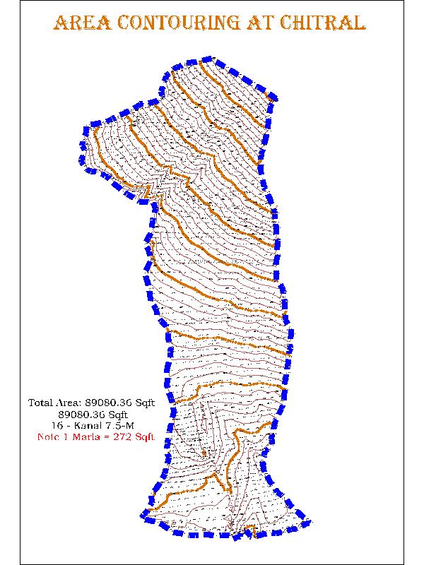
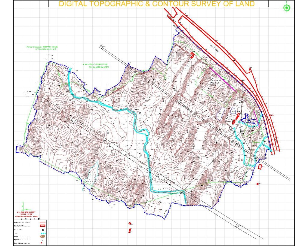
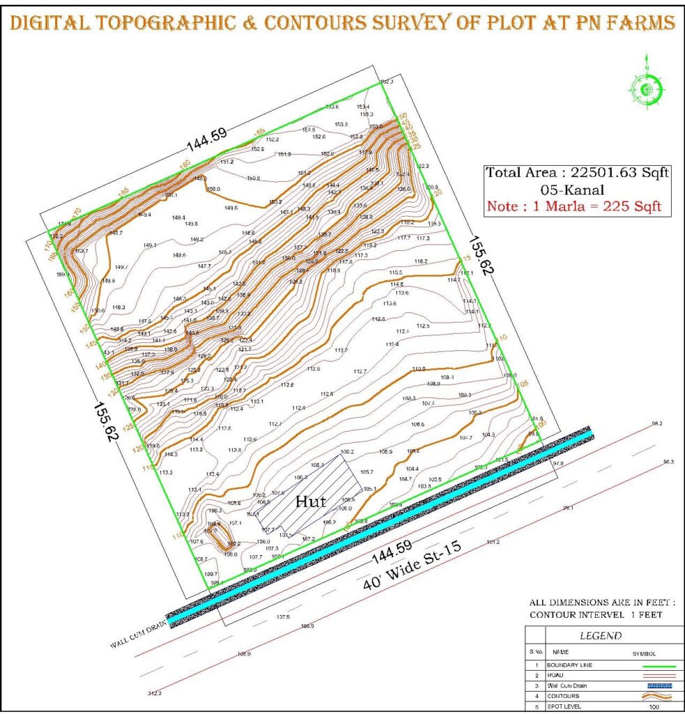
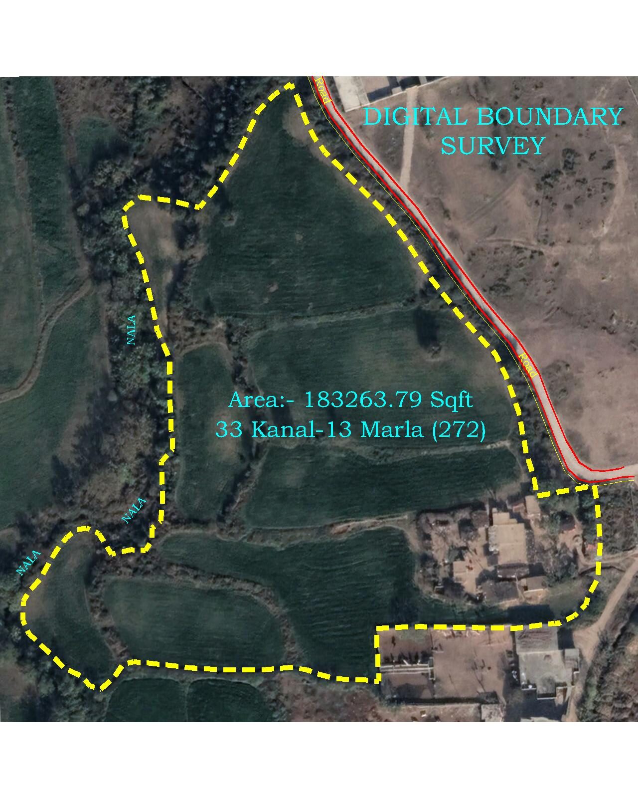
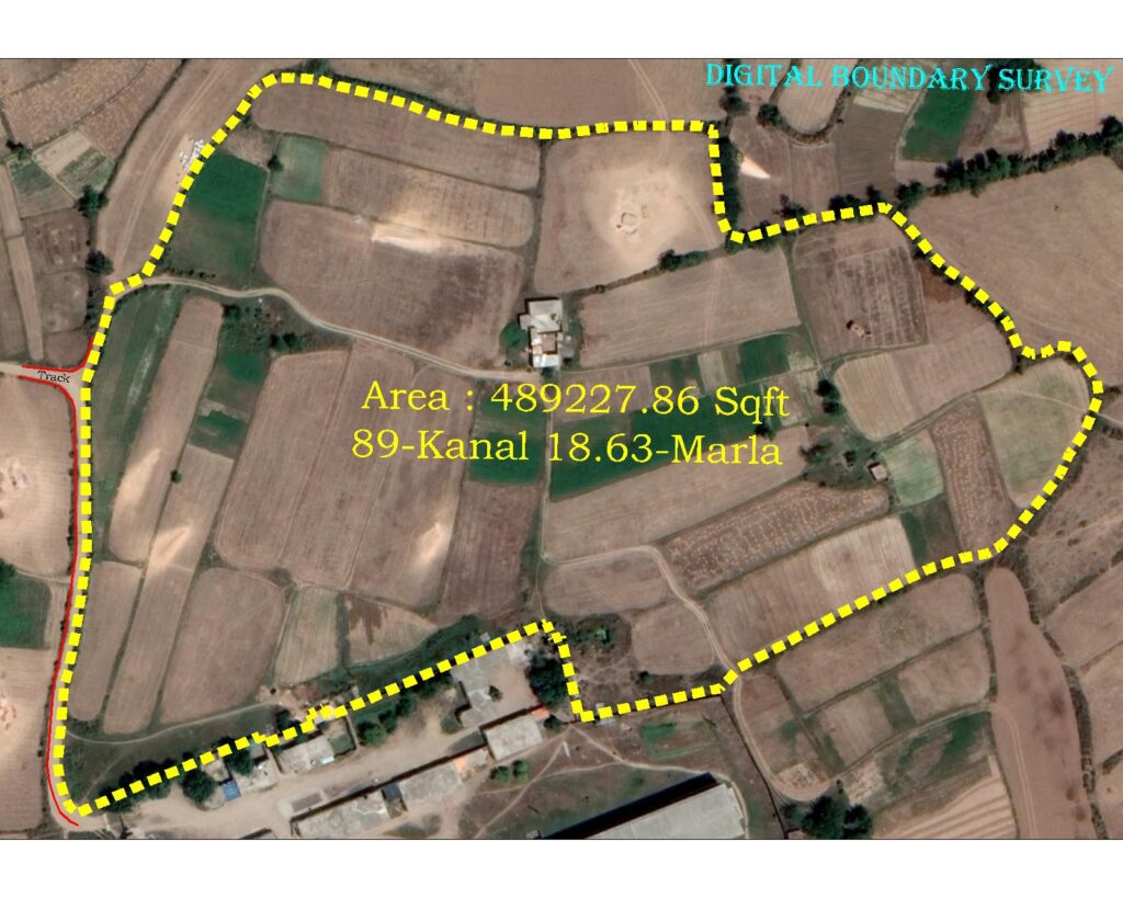
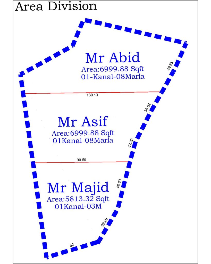
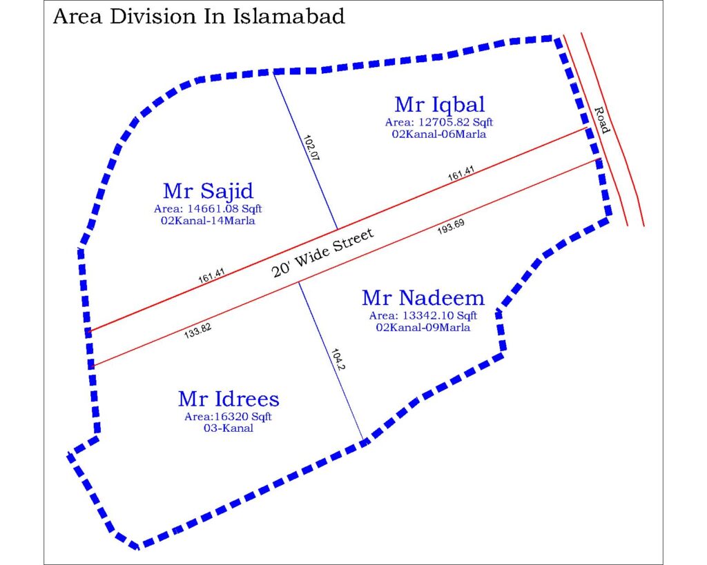
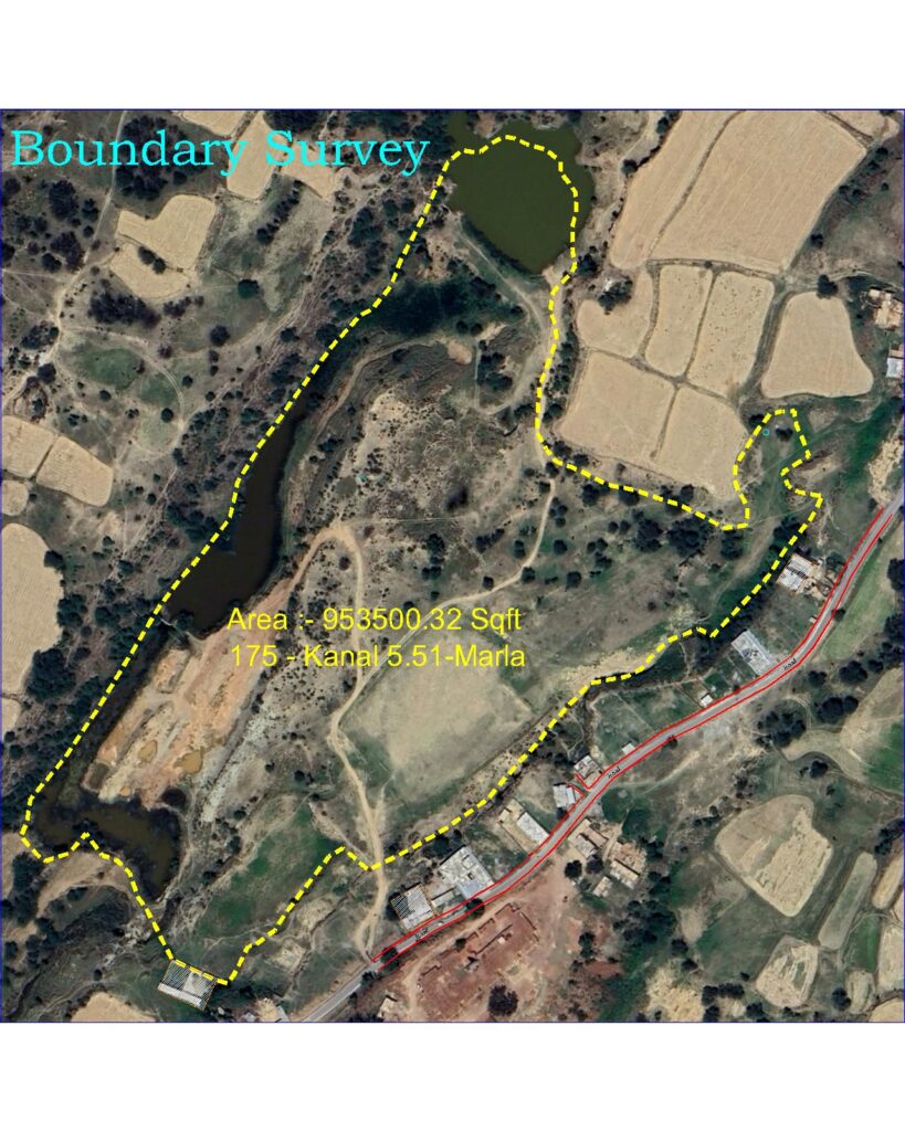
Below are the pictures of topography & contouring.

For explanation of the topographic & contour survey

Area Measurements / Boundary Survey / Area Division.

In boundary survey or raqbay ki paymaish karna, the surveyor moves the surveying rod over the entire boundary of the area. This movement is exactly according to the geographical position of the area's boundary (that is, if the boundary is zigzag then the movement of the surveyor will be exactly according to this zigzag boundary) & close it to the starting point.
Then this data is processed, extracted kanal marlas, and given to the owner in print form.
Apart from this, the area is also divided into different parts and marked on the spot. (Raqbay ko mukhtalif hisson mein taqseem karna or zameen per nishaan bhi laga kar diye jate hain).

A Boundary survey file
Area Division In Islamabad
A Boundary survey file

Town Planning / Master planning of Housing Societies.

Our services also include town planning. Generally, people buy a portion of land or plotting on their own land and sell plots. Here are a few pictures of our many works in town planning.

GIS Mapping & Khasra Demarcations.

In 1955 , when old land record (mussavis, khasras were prepared ….our country was least developed, previous 20 to 30 years there are too much development & construction in our country.so it’s difficult to marking of khasra on latest ground position.(Because raising of new construction) So we are here to demarcate your Number Khasra on latest Imagery and at on ground. A digitized khasra number prepared for demarcation of khasra number at on ground.

Further More

Road X-Sections & L-Section

A Cross-section long section of the road is made. In which every RD wise quantity is also taken out and the existing plan of the road is also prepared. Below are the x-sections and Long-section for illustration.

X-Sections

Long Section & Existing Plan of Road

Building Columns & Excavation Area Lay-out

The layout plan of the building columns & excavation area was designed by the designer to be marked on the ground according to the drawings and coordinates. Recently some sites had column layouts as shown in the images below.

Columns Layout at on ground.
Columns and excavation area Layout at on ground.

Earth Work (Cutting/Filling)

The quantity of soil cutting and filling done at any construction site is extracted in cft. Kisi bhi construction site pe ki gai matti ki khudai or bharai ki quantity maloom ki jati hai.

“Original and with an innate understanding of their customer’s needs, the team at Love Nature are always a pleasure to work with.”

Jane Miller

QUESTIONS?

Whether you’re curious about any work related to land surveying, we’re here to answer any questions.